"We fully realize the importance of critical geospatial infrastructure and information in helping countries and decision-makers make more informed decisions on mitigation and preparedness."
-Ambassador Peter Thompson, Fiji's Permanent Representative to the UN. 26 Feb 2015
Established by the Pacific Region, for the Pacific Region
Geospatial information underpins the majority of economic and sustainable development activities in the world today. The services provided by Pacific Island geospatial scientists and surveyors contribute to the security and well-being of Pacific people, supporting numerous industries and sectors. These include natural resource management, civil engineering, climate change adaptation, disaster risk reduction, transport, land ownership, health, and agriculture to name a few.
In November 2014, a group of Pacific regional surveying and geospatial experts met in the margins of the annual Pacific Geospatial Information Systems and Remote Sensing (GIS/RS) User Conference in Suva, Fiji. It was at this meeting that the Pacific Geospatial and Surveying Council (PGSC) was first envisaged and a charter governing its mission and objectives was developed.
- Building the capacity of regional surveyors
- Improving and standardising geospatial information gathering and dissemination
- Maximising economic growth and alleviating poverty
- Informing natural resource management, disaster risk management and climate change adaptation
The PGSC aims to achieve these goals by coordination, communication, and collaboration as well as sharing resources and applications of location information through regional and global partnerships.
Who We Are
The Pacific Geospatial and Surveying Council, also known as the PGSC, is an independent regional advisory body that provides a forum for Pacific Island geospatial information and survey authorities to discuss and address regional challenges.
Vision
Sustainable development in the Pacific enabled by world-class geospatial information and surveying services.
Members
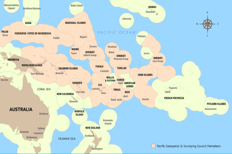
Core members are national geospatial, hydrographic and surveying authorities of Pacific Island countries and territories. At present, these include the following:
- Cook Islands
- Federated States of Micronesia
- Fiji
- Kiribati
- Nauru
- Niue
- Republic of the Marshall Islands
- Papua New Guinea
- Palau
- Samoa
- Solomon Islands
- Tonga
- Tuvalu
- Vanuatu
Learn more about the Pacific Geospatial and Surveying Council Strategy 2017-2027.